Bathymetric Surveys
We provide detailed waterway surveys for permitting, determining amount
of sediment for removal, GPS dredging navigation and project monitoring.
Consulting Services |
GET STARTED
Contact us about dredge engineering, equipment, pumping, and dewatering to
meet your contract
requirements.
What is a bathymetric survey?
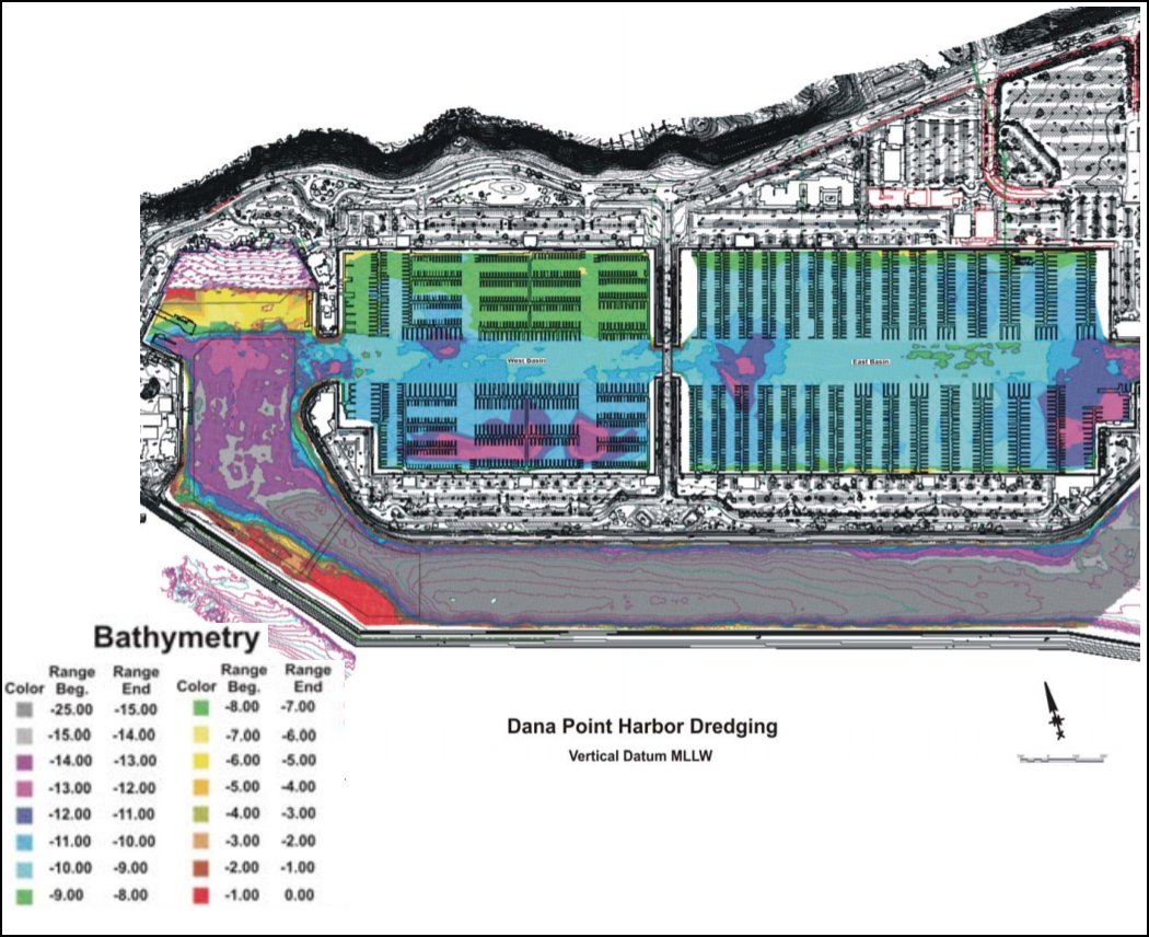
Bathymetry studies the depth of waterbody floors (lakes, seas, oceans). It is basically the underwater version of topography.
A bathymetric survey creates charts that offer information concerning the terrain or relief of the seafloor.
Why is bathymetry useful?
Bathymetric surveys play a significant part in maintaining the safety of both surface and submarine navigation. Having a clear chart of the seafloor also offers key data about the possible site for various resources or geophysical exploration.

How is bathymetry data gathered?
The survey uses sonar systems based on physics rules that gather up all the information required.
What does the cost of bathymetric surveys depend on?
There are 3 main factors: staff, equipment, and survey vessel.
Is it possible to save on bathymetric survey equipment?
Deploying staff on the job is the only way to lower the costs in terms of personnel. Many offshore survey operations are efficient by working 24 hours to keep the equipment’s performance.
Survey systems can be optimized and become way more productive thanks to GPS and DGPS developments.
What is a hydrographic survey?
Hydrographic surveys focus on measuring and describing the characteristics that can influence tasks related to maritime navigation and construction, as well as dredging and offshore oil jobs.
What’s the difference between a bathymetric and a hydrographic survey?
Both types of surveys are related to submarine topography. Yet they don’t focus on the same things. The information provided by hydrographic surveys serves to get a bathymetric map.
What is LIDAR?
LIDAR is a remote sensing system that relies on a laser’s pulse to gather measurements. Then it produces helpful maps of the studied environments and objects, as well as comprehensive 3D models.
Radar uses radio waves, while sonar uses sound ones. LIDAR performs similarly to these ones as it uses a laser’s light waves.
There can be huge quantities of data generated at a remarkable speed. This means that it’s possible to quickly study significantly large areas.
Notably, massive tasks might require a plethora of sensors that have to be used for a long time. In this case, it can be cost-effective to go for a Zeppelin-type aircraft as it facilitates the survey of big spaces at a fair price and within a reasonable amount of time.
LIDAR mixed with RTK-DGPS / Inertial systems will offer solutions for specific purposes such as surveying clean water that is not very deep.
GET STARTED
Contact us about dredging consulting, equipment, pumping and dewatering to meet your contract requirements.


